

I imagine myself standing in a topless hut on the rocky shores of Spitsbergen, half way between the fjords of Norway and the North Pole. It is 11 July, 1897, and most of the hut is taken up by a huge hydrogen balloon.

In the basket suspended beneath that leaking gas bag is a jar headed Swedish engineer named Salomon Andree.

It was Andree who had dreamed up a flight to the North Pole in a hydrogen balloon. And he sold the idea to investors, from average patriotic Swedes to scientific geniuses like Afred Nobel. Now, as he reaches out to shake my hand, a puzzled look comes over Andree's face. Where, he must be wondering, did I come from? But there is no time for explanations. I grasp his hand and pull him close. I whisper in his ear a final warning, “Ekholm was right. You have failed to face reality. That makes you the biggest idiot within ten thousand miles.” Andree nods and smiles absently. After all, he doesn’t speak English.

He shouts, “Strindberg! Fraenkel!” Instantly, obediently, the slender Nils Strindberg (above, centrer) and bullet shaped Knute Franknel leap into the basket, like two eager well trained sacrificial lambs. The ropes are cut, and the Ornen (the Eagle) rises into the cold clear air and floats away. The three men are never seen alive again. What idiots.
 Nils Ekholm had joined Andree in Spitsbergen for his first attempt at floating a balloon to the North Pole in 1896, but the southerly winds Andree had confidently predicted never showed up. The delay gave Ekholm time to come to the disturbing revelation that the balloon named the Eagle ("Ornen" in Swedish) was leaking like a kitchen sieve. It would never, he realized, stay inflated long enough to reach the Pole, let alone safety on to a farther shore like Alaska or Russia. When he expressed his reservations, Andree expressed disappointment with Ekholm’s lack of enthusiasm. After the flight was cancelled for the year Ekholm made alternative travel plans for the summer of 1897.
And that was how Knut Fraenkel earned a chance at immorality and trichinosis; lucky him.

If the leaking gas bag had been the only problem, the expedition would have have still been in trouble. In truth there was an almost endless list of mistakes and false assumptions that insured doom, and all of them lead straight back so Salomen Andree.

Andree had invented a clever and simple device for steering the balloon by dragging ropes along the ice or water (note the trailing lines, above). Their weight would keep the balloon from rising too high, or being carried too fast into trouble. The only problem was, they didn't work.

Bryan Swope, from his web site "This Day in Aviation" explains that "Problems began immediately. As the guide ropes dragged through the water, they became heavier. They pulled the balloon down to the surface and the gondola actually touched the water. The aeronauts frantically began dumping ballast. Three of the four ropes became entangled and were pulled loose. Örnen began to rise again, but having lost ballast and the weight of the three guide ropes, it climbed to about 1,600 feet (490 meters). The loss of hydrogen accelerated."

"The Eagle floated northward above a fog bank. It sank into the fog and sunlight shining on the envelope decreased.

The balloon cooled and the gas inside began to contract. Buoyancy decreased and the balloon sank further into the fog...After the explorers passed into the Arctic ice pack, the gondola would alternately bounce across the broken ice, then rise again into the sky. At about 10:00 p.m., July 12, the gondola settled on to the ice and remained there for the next thirteen hours"

At 10:55 a.m., 13 July, once again airborne...Drizzle and fog caused ice to form on the envelope. The gondola dragged behind. After jettisoning hundreds of pounds of ballast and equipment, Örnen rose higher, but again settled toward the ice. The remaining guide rope was lost. Realizing that the end of the flight was inevitable, the crew opened to valves to release the hydrogen.

The balloon settled to the ice, and at 8:11 p.m., 14 July 1897, the crew climbed down from the gondola onto the ice floe. The total elapsed time of the journey was 65 hours, 35 minutes. In that time, Andrée, Frænkel and Strindberg had traveled 295 miles (475 kilometers) from their starting point..." .

Anticipating such a problem, Andree had designed three clever sleds that folded away for easy storage in the balloon. But they proved so rigid you could break your back trying to pull them across the pressure ridges in the ice.

The three intrepid explorers ended up dragging the boats across the endless ice ridges until they collapsed.

And Andree stocked the balloon with a ton or more of food, almost none of which could be easily transported by foot, should the balloon go down.

Their tiny cook stoves often failed, filling their tiny tent with toxic fumes.

Luckily they had also brought guns, assuming they would be able to feed themselves on seal and polar bear meat if they were forced down on the ice. But when prepared upon the inefficient stoves, they undercooked the meat, contracted trichinosis and died of dysentery; not the fate most 19th century explorer-romantics usually envisioned for them selves, death by constant toilet.

After they disappeared into the sky on 11 July 1897, for 33 years the assumption was that the brave trio had made it to the Pole but crashed while floating to make landfall in Russia or Alaska, a thousand miles beyond rescue. Then in August of 1930 a Norwegian scientific ship stumbled on the remains of their last camp, not more than 200 miles from their starting point.

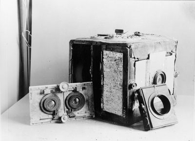
The Norwegians found only what little the polar bears had left of the three bodies, but Andree and Franknel's journals and Strindberg's extraordinary photographs of the dead men remained. That was when the whole truth became known.
On July 14th, the Ornen had crashed onto the ice, after just 51 hours in the air. (Stridberg took extensive photos of the 'landing'.) The three men then spent a week unpacking and deciding what to do. Only then did they set out for home.

They left behind the champagne and beer, but struggled to carry the cans of condensed milk and sausages and cheese. A week’s trek across the ice taught them the lesson and they abandoned almost half of their burden in big pile, and kept going. They had worn no furs but rather heavy woolen clothing, covered at times by oilskins, that trapped the moisture underneath until they were swimming in their own sweat.

As they marched, each two steps they took to the south were countered by the floating ice pack which carried them one and a half steps toward the north and east.

They clambered over two story high pressure ridges, sometimes reduced to crawling on all fours. They struggled over broken ice alternating with water leads that forced them into and then out of their clumsy boat, soaking their woolen clothing again and again.

Slowly they came to the realization that, for all the effort, they were not making much progress. By the middle September they decided they were going to have to winter on the ice. They built an elaborate snow hut and prepared to float southward on the ice, which they finally realized by watching the shores of White Island (now called Kvitoya Island) drift slowly past their camp, was carrying them away from safety.

But in early October the pack ice cracked right down the middle of their new home, and they were forced to drag their gear onto the rocky shores of Kvitoya island, barely 200 miles to the northeast of their starting point. They used the last of their strength to build a final camp on the island.

Shortly after they landed thin and graceful Strindberg died of an apparent heart attack. His comrades buried him under stones in a cleft in the rocks.

Within a few days Franknel and Andree also died in their little hut. A hunk of frozen polar bear meat found near their stove thirty-three years later was infected with trichinosis spores. And then the bears came in to claim their winnings.

They had survived for 11 weeks on the open ice, perhaps the most ill-prepared polar explorers in history. But they had transcended their own stupidity with courage and tenacity. In the end they were killed by a bad plan and bad planning.

But as one writer has since noted, “Posterity has expressed surprise that they died on Kvitøya, surrounded by food…The surprise is rather that they found the strength to live so long".

I would put it slightly differently. I find it unimaginable that Saloman Andree would ever admit defeat, even if he knew he was dying.

- 30 -


